


Voting District 0200057, Suffolk County, New York
About
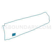
Outline

Summary
| Unique Area Identifier | 637707 |
| Name | Voting District 0200057 |
| County | Suffolk County |
| State | New York |
| Area (square miles) | 25.96 |
| Land Area (square miles) | 1.52 |
| Water Area (square miles) | 24.44 |
| % of Land Area | 5.85 |
| % of Water Area | 94.15 |
| Latitude of the Internal Point | 40.66619750 |
| Longtitude of the Internal Point | -73.07240100 |
Maps


Graphs
Select a template below for downloading or customizing gragh for Voting District 0200057, Suffolk County, New York


Neighbors
Neighoring Voting District (by Name) Neighboring Voting District on the Map
- Voting District 0200014, Suffolk County, NY
- Voting District 0200048, Suffolk County, NY
- Voting District 0500008, Suffolk County, NY
- Voting District 0500018, Suffolk County, NY
- Voting District 0500019, Suffolk County, NY
- Voting District 0500024, Suffolk County, NY
- Voting District 0500037 0500165, Suffolk County, NY
- Voting District 0500038, Suffolk County, NY
- Voting District 0500049, Suffolk County, NY
- Voting District 0500078, Suffolk County, NY
- Voting District 0500130, Suffolk County, NY
- Voting District 0500132, Suffolk County, NY
Top 10 Neighboring County Subdivision (by Population) Neighboring County Subdivision on the Map
Top 10 Neighboring Place (by Population) Neighboring Place on the Map
- Sayville CDP, NY (16,853)
- Bayport CDP, NY (8,896)
- Oakdale CDP, NY (7,974)
- West Sayville CDP, NY (5,011)
- Blue Point CDP, NY (4,773)
- Great River CDP, NY (1,489)
- Fire Island CDP, NY (292)
Top 10 Neighboring Unified School District (by Population) Neighboring Unified School District on the Map
- Connetquot Central School District, NY (40,162)
- East Islip Union Free School District, NY (25,176)
- Sayville Union Free School District, NY (18,580)
- Bayport-Blue Point Union Free School District, NY (13,965)
- Fire Island Union Free School District, NY (408)
Top 10 Neighboring State Legislative District Lower Chamber (by Population) Neighboring State Legislative District Lower Chamber on the Map
- Assembly District 3, NY (143,108)
- Assembly District 5, NY (131,677)
- Assembly District 8, NY (128,281)
Top 10 Neighboring State Legislative District Upper Chamber (by Population) Neighboring State Legislative District Upper Chamber on the Map
Top 10 Neighboring 111th Congressional District (by Population) Neighboring 111th Congressional District on the Map
Top 10 Neighboring Census Tract (by Population) Neighboring Census Tract on the Map
- Census Tract 1476.02, Suffolk County, NY (5,367)
- Census Tract 1477.02, Suffolk County, NY (5,011)
- Census Tract 1588.02, Suffolk County, NY (4,773)
- Census Tract 1479.02, Suffolk County, NY (4,381)
- Census Tract 1478.02, Suffolk County, NY (3,905)
- Census Tract 1475.03, Suffolk County, NY (1,489)
- Census Tract 1470.04, Suffolk County, NY (317)
- Census Tract 1595.10, Suffolk County, NY (82)
Top 10 Neighboring 5-Digit ZIP Code Tabulation Area (by Population) Neighboring 5-Digit ZIP Code Tabulation Area on the Map
- 11706, NY (62,543)
- 11772, NY (44,837)
- 11782, NY (15,814)
- 11730, NY (14,712)
- 11769, NY (9,506)
- 11705, NY (8,030)
- 11715, NY (4,752)
- 11796, NY (4,056)
- 11770, NY (137)